
If you want to get out and about cycling around Fort William there are many routes you can take, both long and short that will enable you to to see some fantastic views and get some exercise at the same time.
Fort William is known as “the outdoor capital of the UK” and for good reason. There are many different outdoor activities you can participate in, but surely one of the most enjoyable is to get on a bicycle and explore the area.
From our guesthouse you can go to many different places without risking cycling on busy roads, such as Glen Nevis, Lundavra, the Nevis Range and the Caledonian Canal. Whatever you level of fitness there is plenty to choose from in the area around Fort William to cycle.
Glen Nevis
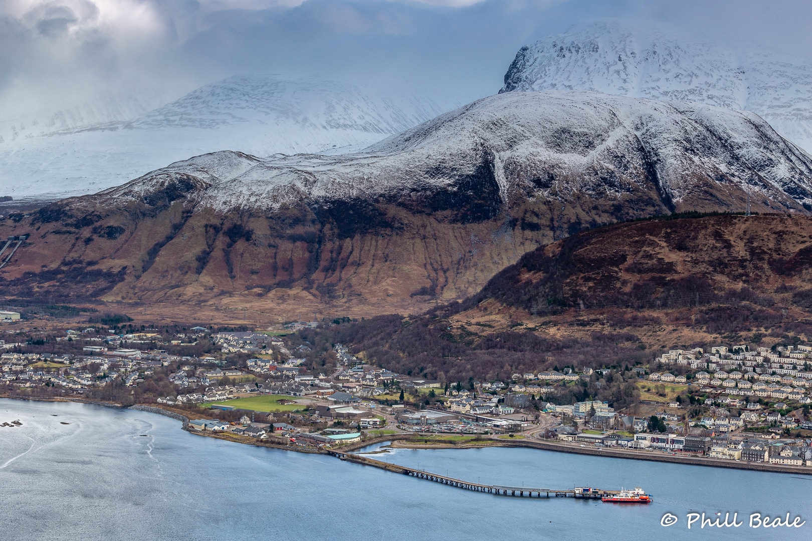
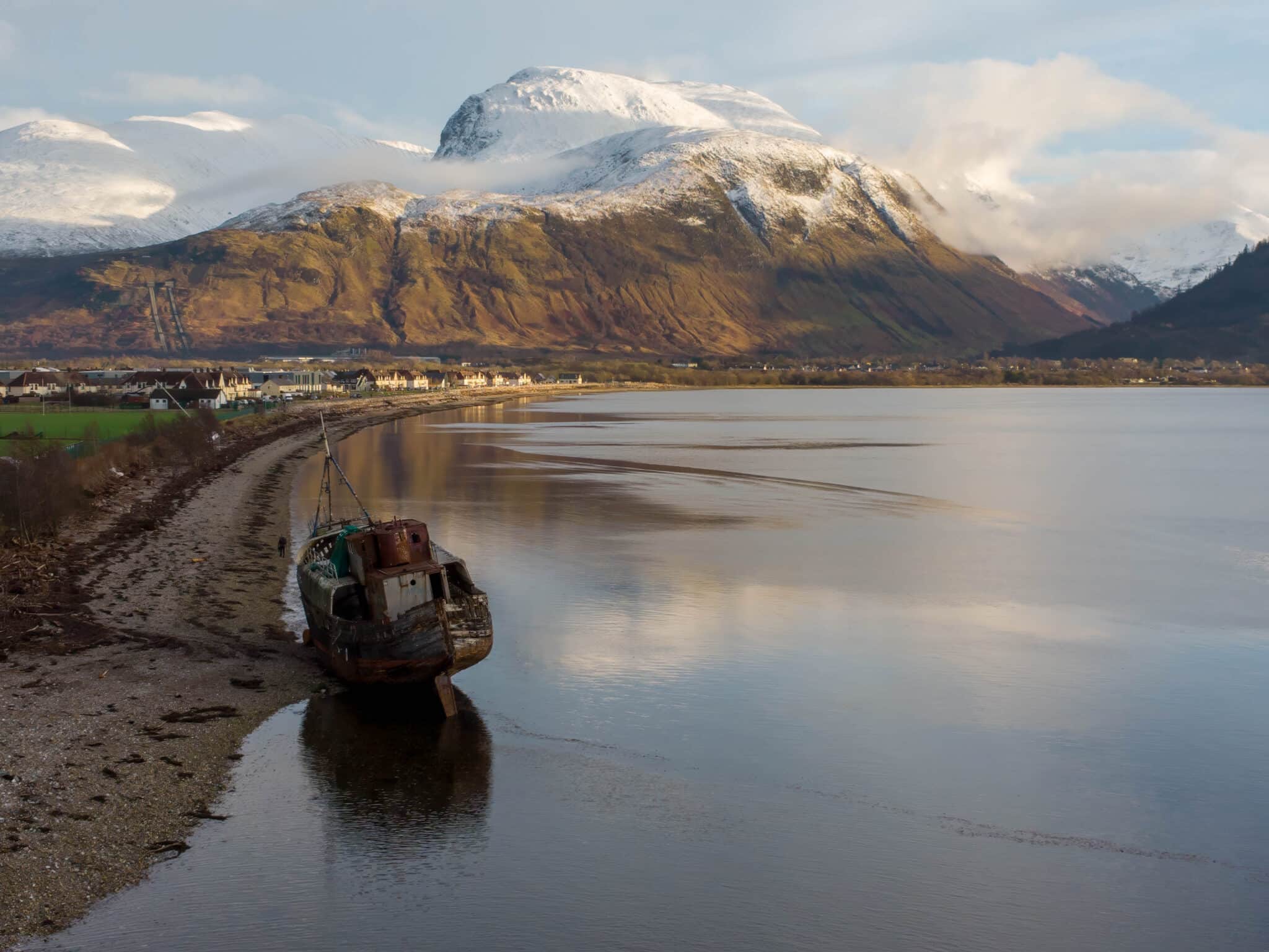
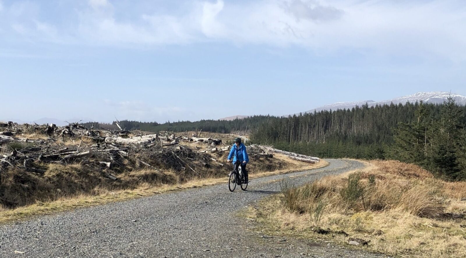
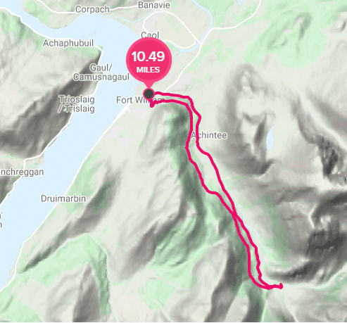
Glen Nevis is the valley (or glen) that is immediately beside Ben Nevis. From the town there is a road that winds along the floor of the glen until you feel you are surrounded on all sides by mountains.
There is a gravel track that more or less runs parallel to the road through an area of forestry.
You can cycle as far as the Lower Falls where the river crosses the River Nevis, or you can continue to the end of the road where there is a small car park with a cycle rack for you to lock up your bike. If you don’t mind a walk, from there you can hike to the top of the glen via the gorge to Steall Falls which is an impressive sight.
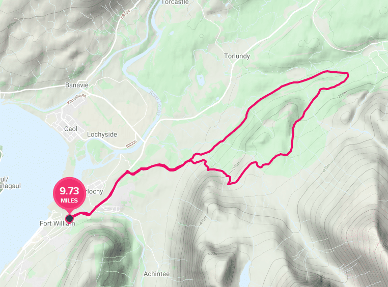
One of my regular routes is to go along the track up through the forest and then back along the road. An alternative route from this track is to Dun Deardail Fort which takes you up the side of the glen to the site of an ancient hill fort.
Lundavra
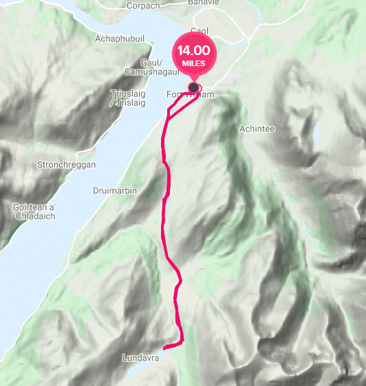
Another favourite Fort William cycle route of ours, because very quickly you can feel as if you are in the middle of nowhere is to Lundavra (pronounced Lundabra).
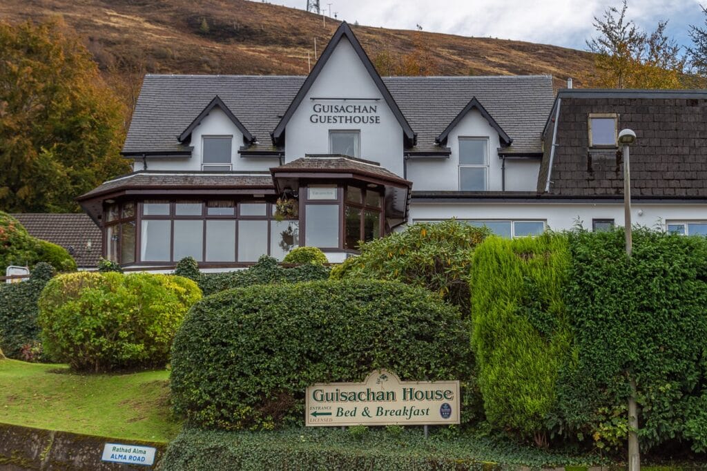
From Guisachan House turn up the hill and along Alma Road. At the end cross the junction onto Argyll Road and continue to the end which joins Lundavra Road. This goes up the hill past the Primary School and once you pass the last of the houses you are in the countryside.
This road continues for about 7 miles, up hill and down until you reach the end where there is a farm and lochan called Lochan Lunn Da-Bhra.
Near the end of the road, you can connect with the West Highland Way path between Fort William and Kinlochleven. If you’re feeling adventurous you can cycle in either direction along the West Highland Way route, but it’s not very cycle friendly unless you have a mountain bike.
The Nevis Range
The Nevis Range is a fantastic place to go cycling. There are many cycle routes that you can explore there, as they have built a number of mountain bike tracks around the area for all levels. The Nevis Range has its own website where you can explore the different cycle trails.
But if you want some exercise and just want to enjoy the ride, the route to the Nevis Range and back is very enjoyable, albeit with quite a steep climb/descent next to the hydro penstocks that feed the power plant at the smelter.
At the top of the route you are in the shadow of the north face of Ben Nevis and Càrn Mòr Dearg.
This route go along the A82 through town, but some of this is a designated cycle path and if you are that concerned there are alternative options.
Caledonian Canal to Gairlochy
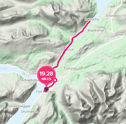
The Caledonian Canal is a marvel of Victorian engineering that goes between Fort William and Inverness via the three main lochs of the Great Glen (Loch Lochy, Loch Oich and Loch Ness).
The longest stretch of actual manmade canal is the section from Fort William to Gairlochy which is approximately ten miles north of Fort William.
The cycle route near Fort William is more or less flat, and takes in Corpach basin where the canal joins Loch Linnhe, via Neptunes Staircase which is a series of locks that raise the level of the canal some 19 metres over about a quarter mile.
From there the route is well made and relatively flat as it takes you to the village of Gairlochy at the southern end of Loch Lochy.
From there you can either retrace your route along the canal of take the B8004 road back toward Banavie and Fort William.